
Updated on May 19, 2024 @ 6PM
|


Now Updated for the 2024 Season!
Current Weather Links:


| Weather Pictures | Fulton Google Maps | ||
| Local Weather Stats | Fulton Area Maps |
Additional Links:
SUNY Oswego Webcam
New York State Golden Snowball Award Contest
2007 Oswego County Lake Effect Storm Video
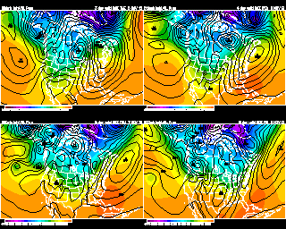
Weather Models and Links
8 Day Forecast:
Monday |
Tuesday |
Wednesday |
Thursday |
Friday |
Saturday |
Sunday |
Monday |
 |
 |
|
 |
|
|
|
|
High: 82 |
High: 86 |
High: 90 |
High: 78 |
High: 68 |
High: 70 |
High: 76 |
High: 74 |
Low: 62 |
Low: 64 |
Low: 66 |
Low: 53 |
Low: 51 |
Low: 56 |
Low: 58 |
Low: 57 |
|
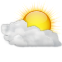
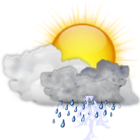
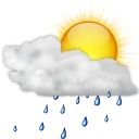
Forecast Discussion: High pressure will be over the area on Monday, giving us sunshine and a few clouds. A very warm day on Tuesday with a mix of sun and clouds. There is a slight chance of a couple of isolated showers around the area. A hot day on Wednesday. It will be a bit humid, but not as bad as it could be. We will have a chance of thunderstorms coming through later in the day. A cold front is forecast to move through later Wednesday night or Thursday morning. A left over shower possible Thursday morning. A then a more comfortable afternoon with sun and clouds and lower humidity. The coolest day of the week should be Friday. But we will remain dry with a mix of sun and clouds. At this time next Saturday looks dry and pleasant. Mild next Sunday with partly cloudy skies. A chance of an evening shower. Clouds and some sun next Monday. A chance of scattered showers and thunderstorms at times. |
Meteorologist
Anthony Corsoniti

Bachelor's of Science in Meteorology
from SUNY Oswego
Anthony Corsoniti
Bachelor's of Science in Meteorology
from SUNY Oswego